- ASDC Search and Subsetting Web Applications
- Introductory Page
Available Subsetters
The ASDC offers subsetting web applications for the following projects:
The following are subsetting web applications external to the ASDC:
Introduction
Welcome to the ASDC Search and Subsetting Web Applications. Each of these tools enables a more sophisticated approach to selecting and ordering project data by date, time and geolocation.
What is Subsetting?
A subset is defined as a set that is part of a larger set. The ASDC subsetters give the user three subsetting options that can be used individually or in combination with one another.
- Parameter Groupings
- For each project, data parameters have been grouped together based on type. The user may select which parameter groups, as well as which data variables from these parameter groups, to include. The final output will also include a default group of data variables.
- Temporal
- The user is given the opportunity to narrow their search to a specific temporal range. Any available data that intersects with the selected time range will be returned.
- Geospatial
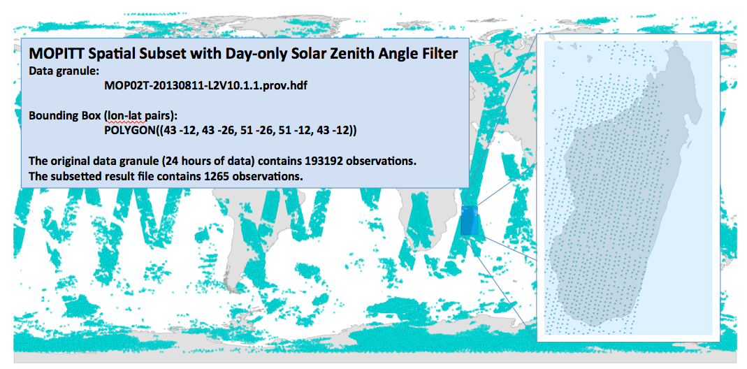
- The user can select to search either the entire globe or a specific geospatial area. If a specific region is selected, any available data that intersects with that region will be returned. Below is an example of a geospatially subsetted footprint and its output (select the image to see the full size).

What Data is Available?
The ASDC subsetters offer the following data products:
To begin ordering data, please select the desired project from above. Access to the application web site requires that users login with an EOSDIS Earthdata Login account. Please contact ASDC User Services (support-asdc@earthdata.nasa.gov) if you need assistance.
We highly encourage that you send us your feedback using the URL at the bottom of the page; every bit of feedback will allow us to address issues and add enhancements in future releases.

|
Responsible NASA Official: Jeff Walter Site Administration/Help: NASA Langley ASDC User Services (support-asdc@earthdata.nasa.gov) [Privacy Policy and Important Notices] Accessibility Last Updated: December 22, 2025 |